Aerial Photos Of Flooding On The Mohawk River.
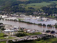
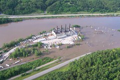
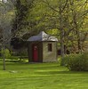
The following aerial photographs of flooding on the Mohawk River were taken on June 28, 2006 by the Montgomery County Sheriff’s Department.
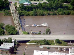
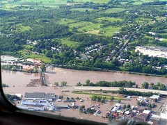
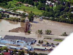
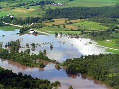
The first three photos show flooding in Canajoharie, NY, with the third photo showing the Beechnut Factory. The fourth photo shows flooding on Route 5 near the intersection of Route 67 between Nelliston and St. Johnsville. The farm in the left center of the photo is an Amish farm that we used to buy baked goods at. The fifth photo shows flooding at the Fonda Fairgrounds, and the last photo shows flooding at the Cranesville Block Company, which was formerly the Adirondack Power and Light Company, near Lock 10 on the Mohawk River.
The first three photos show flooding in Canajoharie, NY, with the third photo showing the Beechnut Factory. The fourth photo shows flooding on Route 5 near the intersection of Route 67 between Nelliston and St. Johnsville. The farm in the left center of the photo is an Amish farm that we used to buy baked goods at. The fifth photo shows flooding at the Fonda Fairgrounds, and the last photo shows flooding at the Cranesville Block Company, which was formerly the Adirondack Power and Light Company, near Lock 10 on the Mohawk River.
Click on the photos to enlarge them.
posted by Anonymous at
5:48 PM
![]()
![]()


0 Comments:
Post a Comment
<< Home